Northeast of La Paz, lies one of the most spectacular massifs of the Eastern Andes. This is not a trek for the casual walker. It is for those who want to feel the raw, breathing heart of the high mountains—where the air is thin, the silence is absolute, and the landscapes shift from glacial ice to green valleys in just three days.
You begin beside a serene high-altitude lake at 4,700 meters, surrounded by rugged peaks. You climb toward a turquoise lake at the foot of the Ventanani Glacier, where vast ice fields spill down from snow-dusted summits. You ascend to a pass near 5,200 meters—the highest point of the circuit—and then descend through waterfalls, hidden lakes, and softening terrain to the charming valley village of Botijlaka at 3,600 meters.
This is a trek of isolation and connection. Of sharp ridgelines and mirror-like waters. Of llamas grazing on the slopes and glaciers groaning in the distance.
Few hikers ever experience this route. With AHE, you will be among them.
The journey begins early, with a drive northeast from La Paz. The city falls away. The road climbs into the foothills, then higher still, until the landscape opens into the Eastern Andes massif—a world of steep ridgelines, snow-dusted summits, and an immense, silent sky.
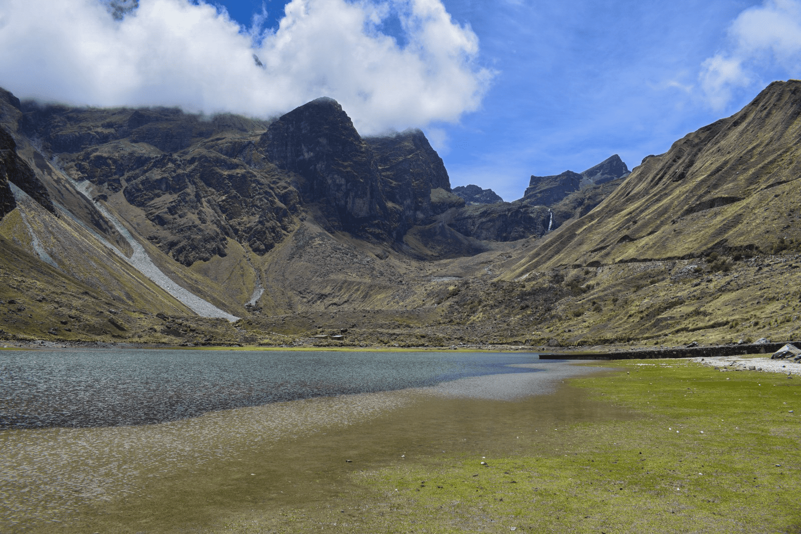
By mid-morning, you arrive at the trailhead: Uri-Kota Lake, a high-altitude lake at approximately 4,700 meters. The water is clear and cold, reflecting the jagged peaks that rise on all sides. There is no village here, no houses, no sign of human life—only the wind, the water, and the mountains.
You take your first steps along the trail. From the very beginning, the scenery feels dramatic. Sharp ridgelines cut the sky. Snow dusts the higher summits. The reflection of the mountains trembles slightly on the surface of the lake. The air is thin and bright.
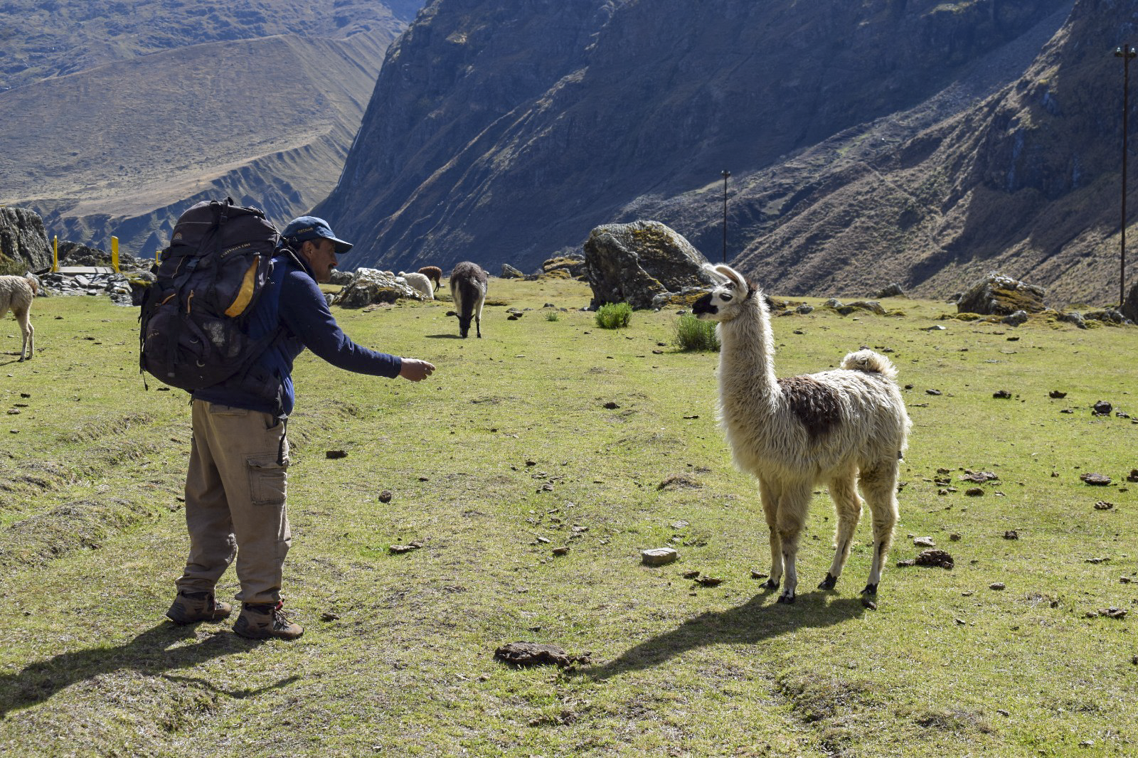
As you climb away from Uri-Kota, the path rises gently at first, then more steadily. Small herds of llamas graze on the slopes near the shoreline, adding subtle movement to an otherwise silent world. They lift their heads to watch you pass, then return to their grazing—unconcerned, as if trekkers are a rare but not unwelcome curiosity.
The terrain is rocky, alpine, treeless. You are walking on the roof of the Andes. By late afternoon, you arrive at your first night’s camp or basic refuge—still high, still cold, but wrapped in a silence so deep you can hear your own heartbeat.
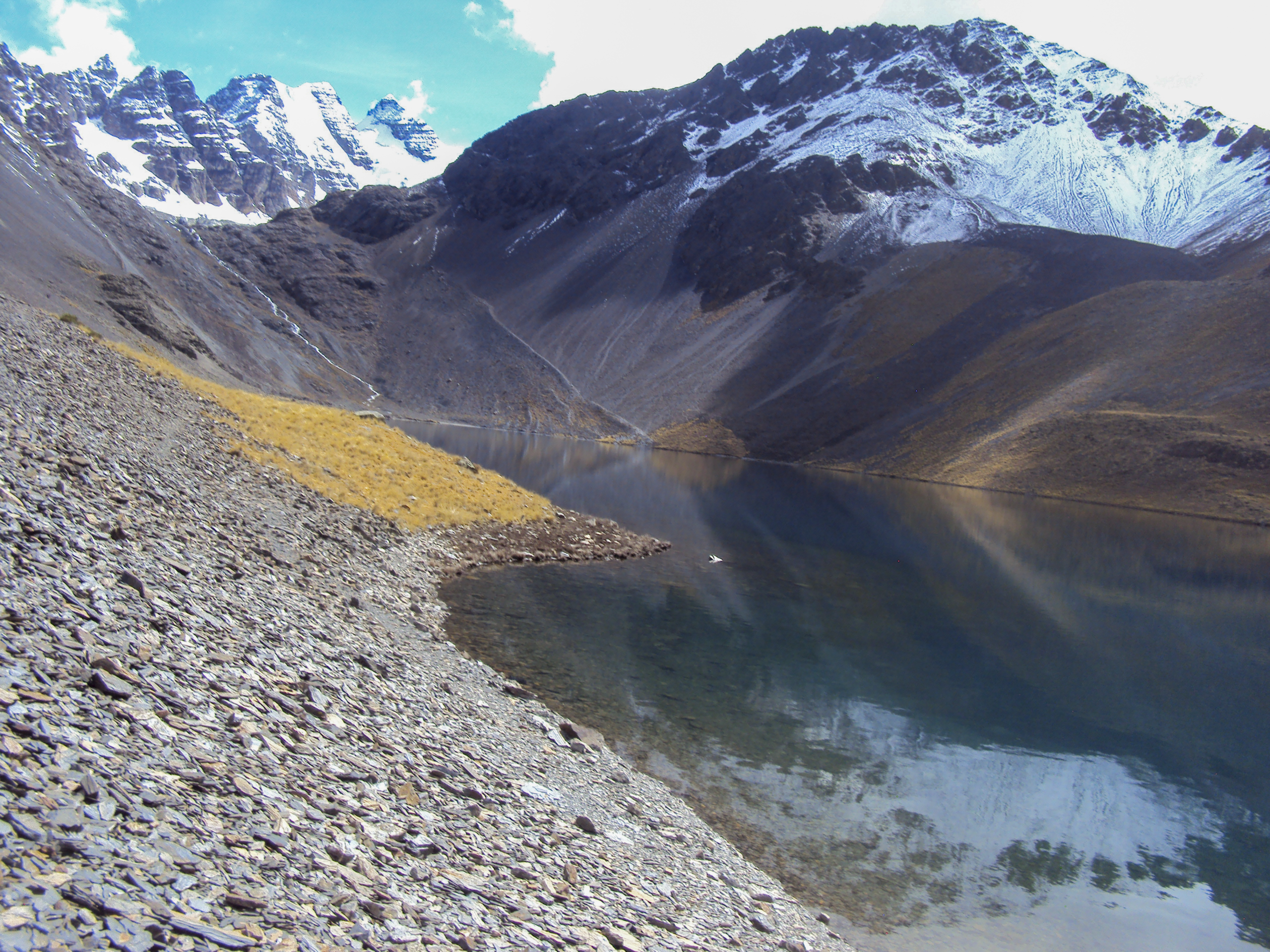
You continue climbing toward Slovenia Lake, the views becoming even more impressive with every step. The path winds between rocky outcrops, crossing small streams fed by melting ice. The peaks draw closer. The air grows thinner.
Then, you see it.
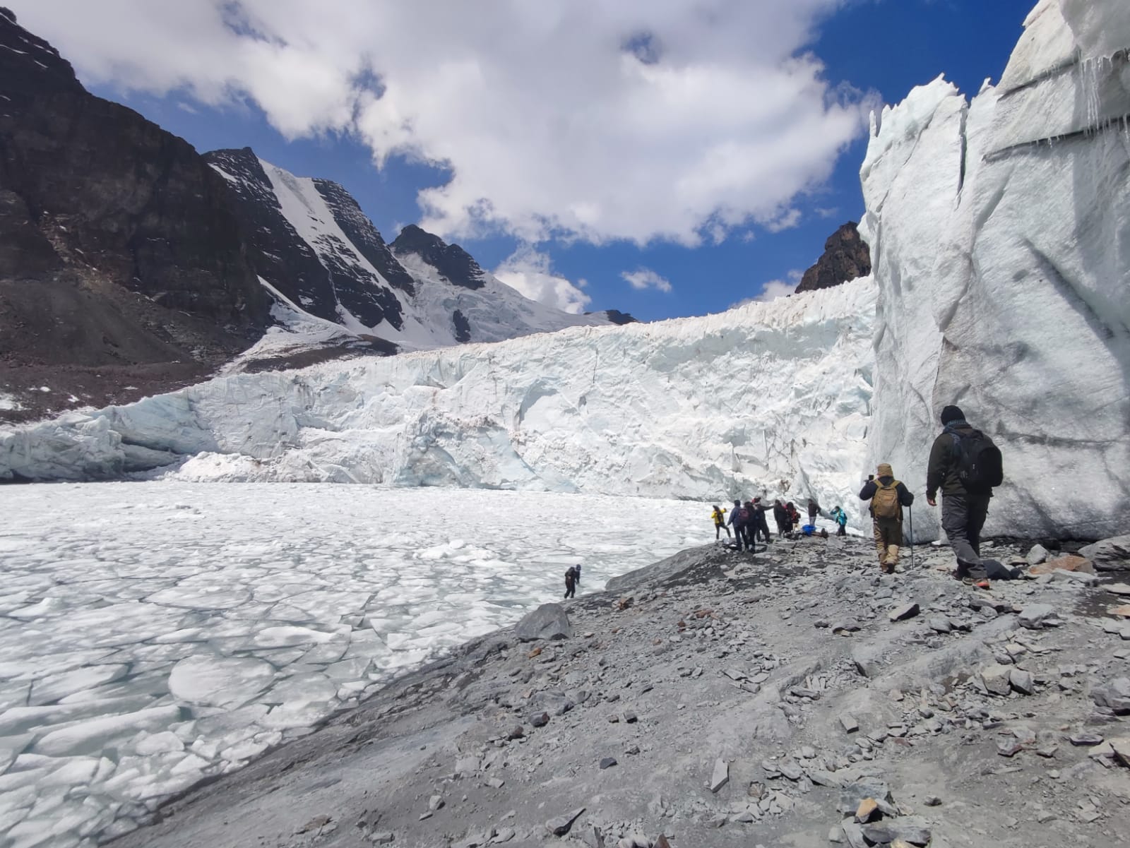
Below you, resting at the foot of the Ventanani Glacier, lies a lake of astonishing turquoise blue.
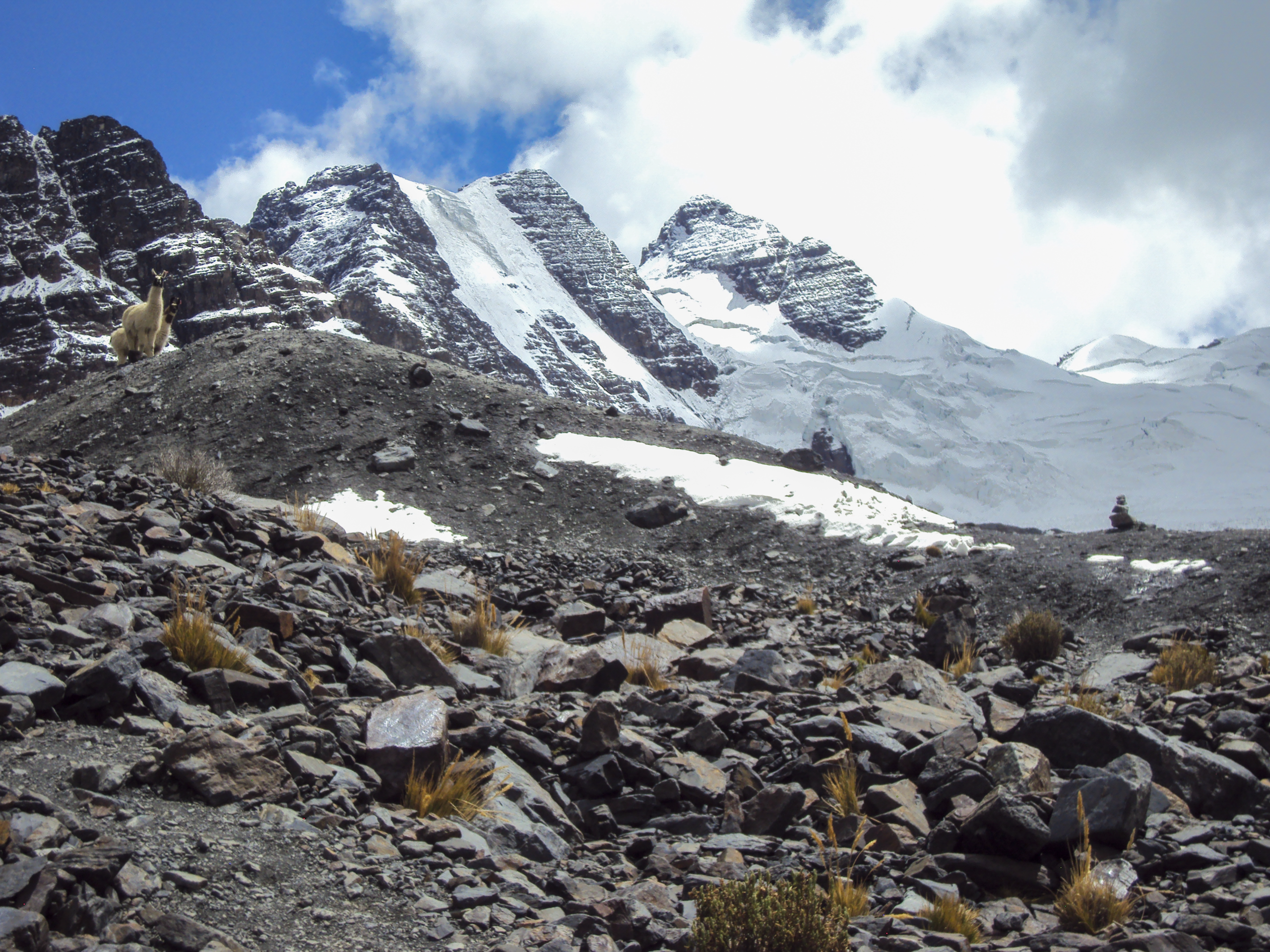
You stop here for a while. Lunch by the turquoise water. Perhaps you walk closer to the glacier’s edge, feeling the cool breath of ancient ice. Llamas graze on the slopes above, their silhouettes dark against the snow.
But the highest point awaits.
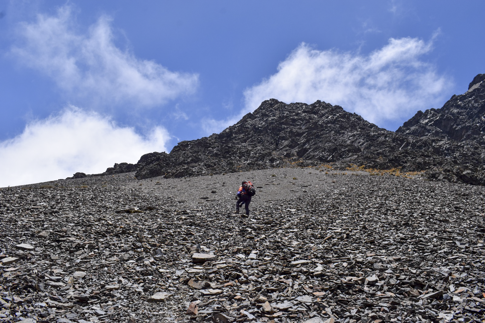
You ascend toward a high pass near 5,200 meters—the summit of the circuit. The trail steepens. Each step requires effort. The air is half of what you are used to. But your guide sets a slow, steady rhythm, and you follow.
The pass opens like a door. From here, the panorama unfolds in all directions: snowy summits, hanging glaciers, hidden lakes scattered between rocky basins. The Ventanani Glacier sprawls below you. Other peaks—unnamed on most maps—rise to the north and south. The wind carries only silence.
You stand at 5,200 meters. There is no hurry. You breathe slowly. You look. You remember.
The descent begins gently, then steepens. You drop toward another high lake at approximately 4,600 meters—a different perspective of the massif and its many glaciers. The light changes. The shadows lengthen.
Tonight, you camp or stay in a simple shelter at a lower altitude. The air is still cold, but the valley offers some protection. Dinner tastes like the best meal you have ever had.
As the sun sets, the peaks around you turn gold, then rose, then deep purple. The stars emerge one by one, then all at once, spilling across a sky unbroken by any light pollution.
You sleep wrapped in warmth and wonder.
Morning comes cold and brilliant. Frost glitters on the rocks. Your breath fogs the air. But the sun climbs quickly, and with it, the temperature.
Today is the heart of the trek.
You continue along the flanks of neighboring mountains, crossing additional passes near 4,900 meters. Each step down softens the terrain. The sharp ridgelines begin to round. The rocky ground gives way to scattered grasses, then shrubs, then the first stunted trees.
Waterfalls appear—some distant silver threads on canyon walls, others close enough to feel the mist on your face. Small cascades tumble beside the trail. Lesser-known lakes, unnamed on any tourist map, gleam between hills. Every turn offers a new composition of light, water, and stone.
The only regular inhabitants you meet are llamas and alpacas. The area is virtually unpopulated. You walk for hours without seeing a single house, a single road, a single sign of human life beyond the ancient trail beneath your feet. This is the isolation you came for—a deep, nourishing silence that lets you hear yourself think.
The final day brings a change.
With every kilometer, the environment transitions toward greener, more humid terrain.
By mid day, the valley widens. The vegetation grows thicker. You pass small stone fences, then a few fields, then the first houses.
You arrive in Botijlaka, a small, picturesque valley village at approximately 3,600 meters. The high peaks that dominated the last three days now tower above you as guardians. Children wave from doorways. Someone offers you water. The air is warmer here, softer, fragrant with earth and growing things.
Your vehicle waits. You climb in, tired and quiet, still processing the landscapes you have walked through: the turquoise lake, the glacier, the pass at 5,200 meters, the waterfalls, the llamas, the silence.
The drive back to La Paz winds through the mountains. By evening, you return to the city—but part of you remains up there, on the high pass, looking out at a world of ice and stone.
Three days. One unforgettable immersion in the high Andes.
 Why Trek the Uri-Kota – Ventanani – Botijlaka Circuit with AHE?
This is not a trek for everyone. It is for those who seek isolation, raw beauty, and the challenge of altitude. Few hikers ever experience this route. With AHE, you will walk it safely, confidently, and with a guide who knows every hidden lake and every safe passage.
| Why AHE? | What You Get |
|---|---|
| Very few hikers – you will have the massif almost to yourself | |
| Walk to the foot of Ventanani – feel the breath of ancient ice | |
| Llamas, alpacas, Andean birds – the only inhabitants | |
| Guides trained for 5,200 m – pacing, hydration, safety protocols | |
| Uri-Kota + Slovenia (turquoise) + hidden lakes along the descent | |
| Dozens of photo opportunities in the greener lower sections | |
| A gentle end in a charming valley community | |
| Camping gear, meals, emergency oxygen – all arranged |
We design tailor-made trekking experiences for every level of trekker – from high mountain massifs to tropical valleys and cultural immersion. We take care of every detail, from arrival to departure.
Walk with us. The high Andes are waiting.
| Detail | Information |
|---|---|
| Duration | 3 days / 2 nights |
| Starting point | La Paz City (early morning pickup) |
| Difficulty | High (extreme altitude, rocky terrain, long days) |
| Maximum altitude | ~5,200 m (17,060 ft) – the highest pass of any AHE circuit |
| Minimum altitude | ~3,600 m (11,800 ft) |
| Total trekking distance | Approximately 25–30 km over 3 days |
| Best season | April–October (dry season – trails safer, skies clearer) |
| Accommodation | Camping or basic mountain refuges (no luxury – all adventure) |
| Who it’s for | Experienced high-altitude trekkers, or well-acclimatized beginners with strong fitness |
This trek reaches over 5,200 meters – higher than any other AHE circuit except the Nevado Mine Pass. This is serious altitude. The air at the pass contains roughly half the oxygen you are used to at sea level.
You must:
Acclimatize in La Paz (3,650 m) for at least 2–3 days before starting. Check our day-hike options available.
Hydrate aggressively (3–4 liters of water daily)
Avoid alcohol and heavy foods before and during the trek
Listen to your body – headaches, nausea, extreme fatigue are warning signs
Trust your guide – they are trained to recognize altitude sickness and will adjust the pace or route if needed
This trek is not recommended for first-time high-altitude walkers or anyone with a history of severe altitude sickness.
![]() Sturdy, broken-in trekking boots (ankle support essential on rocky terrain)
Sturdy, broken-in trekking boots (ankle support essential on rocky terrain)
![]() Layered clothing: thermal base, fleece, insulated jacket, waterproof/windproof outer
Layered clothing: thermal base, fleece, insulated jacket, waterproof/windproof outer
![]() Warm hat, gloves, buff/neck gaiter (mornings and evenings are freezing)
Warm hat, gloves, buff/neck gaiter (mornings and evenings are freezing)
![]() Sunscreen (SPF 50+), lip balm, sunglasses with UV protection
Sunscreen (SPF 50+), lip balm, sunglasses with UV protection
![]() Headlamp with extra batteries
Headlamp with extra batteries
![]() Personal water bottle or hydration bladder (3L capacity recommended)
Personal water bottle or hydration bladder (3L capacity recommended)
![]() Small daypack – main luggage can be supported by vehicle or mule (depending on arrangements)
Small daypack – main luggage can be supported by vehicle or mule (depending on arrangements)
| Season | Daytime (High zones) | Nighttime | Conditions |
|---|---|---|---|
| Dry season (Apr–Oct) | 0°C to 10°C | -5°C to -15°C | Clear skies, intense sun, cold nights |
| Wet season (Nov–Mar) | 2°C to 12°C | -2°C to -8°C | Possible snow/rain, more cloud cover, trails muddier |
![]() Experienced high-altitude trekkers
Experienced high-altitude trekkers
![]() Well-acclimatized hikers with strong fitness
Well-acclimatized hikers with strong fitness
![]() Solo travelers, couples, small groups seeking solitude
Solo travelers, couples, small groups seeking solitude
![]() Photographers wanting raw, glaciated landscapes
Photographers wanting raw, glaciated landscapes
![]() Not suitable for first-time trekkers
Not suitable for first-time trekkers
![]() Not recommended for anyone with heart, lung, or blood pressure conditions
Not recommended for anyone with heart, lung, or blood pressure conditions
![]() Not for travelers needing luxury or fixed trail markings
Not for travelers needing luxury or fixed trail markings
This 3-day high-altitude trek pairs beautifully with:
Awqani / Conchamarca / Murmuntani Canyon – add 2 days of gentle stone forests and culture (great for recovery after the high pass)
Kallawaya Circuit – add 3 days of healer culture and hot springs
Titikaka Lake & Moko-Moko – add 6 days of sacred islands and subtropical descent
Let us know if you would like to build a custom multi-adventure package.